Levels and Moors
The Levels and Moors were once known as the ‘summerlands’. It’s thought this is where Somerset got its name. This Local Community Network has a population of 33,600
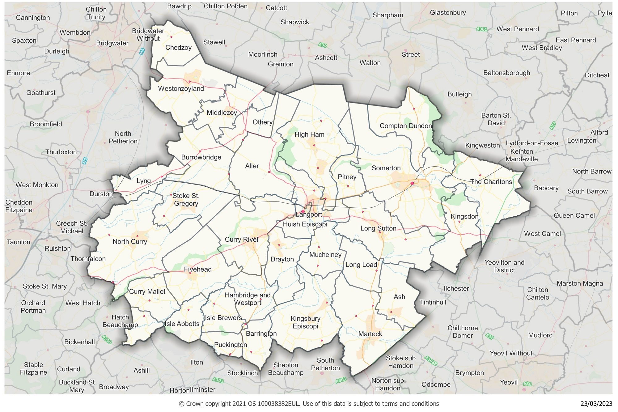
Levels and Moors LCN map

About the Levels and Moors area
The Levels and Moors LCN sits in the centre of Somerset, bordering seven other LCNs .
Primarily a rural area, its parishes include Burrowbridge (famed for its Burrow Mump), Martock in the south, and North Curry to the southwest.
The LCN also includes the market towns of Somerton and Langport with their well-established grassroot community groups, local organisations and networks.
The area is characterised by the inland peat-based Moors and unique Somerset Levels – the Levels being the only place in the United Kingdom where basket willow is grown commercially.
Tributaries of the rivers Tone, Parrett, Axe and Brue run across this LCN area.
Yearly Report
Future meetings
View the full list of upcoming Local Community Network Meetings.
Contact us
Levels and Moors Link Officer:
If you would like to contact the Levels and Moors LCN or the link officer, please email levelsandmoorslcn@somerset.gov.uk
Network members
Stakeholders
- Avon and Somerset Police
- NHS
- Devon and Somerset Fire and Rescue
- Education
- Spark Somerset
- Society Local Council Clerks
- Somerset Association Local Councils
- Somerset Activity Sports Partnership
- Community Council for Somerset
- Citizens Advice
- Department of Work and Pensions
- Somerset Rivers Authority
- Somerset Local Nature Partnership
- Business Chamber
- Young Farmers
- Langport Transport Group
- Kingsbury Episcopi community centre
- Thorney Lakes
- North Curry Pavilion
- Somerton Recreation Ground Trust
- High Ham Community Land Trust
- Connect Somerset
- Somerset Foundation Trust
- WellBe Link (adult mental health)
- First Aid for Mental Health Instructor
Electoral Divisions
- Bridgwater East and Bawdrip
- Curry Rivel and Langport
- King Alfred
- Martock
- Monkton and North Curry
- North Petherton
- Somerton
- South Petherton and Islemoor
Parishes and towns
- Aller
- Ash
- Barrington
- Beercrocombe
- Burrowbridge
- Chedzoy
- Compton Dundon
- Curry Mallet
- Curry Rivel
- Drayton
- Fivehead
- Hambridge and Westport
- High Ham
- Huish Episcopi
- Isle Abbotts
- Isle Brewers
- Kingsbury Episcopi
- Kingsdon
- Langport
- Long Load
- Long Sutton
- Lyng
- Martock
- Middlezoy
- Muchelney
- North Curry
- Othery
- Pitney
- Puckington
- Somerton
- Stoke St. Gregory
- The Charltons
- Westonzoyland
