Exmoor
The Exmoor area features open moorland and spectacular coastal views. Peppered with charming villages, its population is 7,900. The sea, agriculture, and tourism are the main industries.
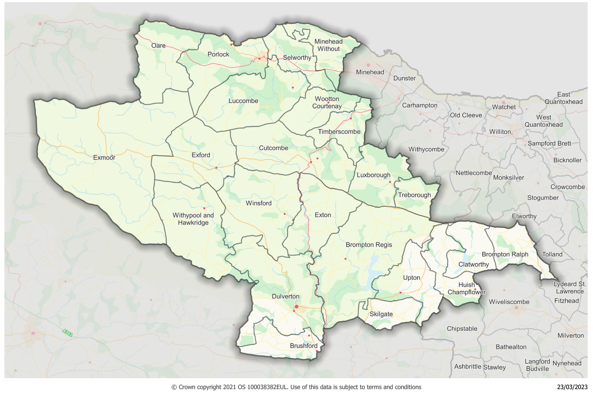
Exmoor LCN map

About Exmoor area
Exmoor contains a variety of landscapes that provide inspiration and enjoyment to visitors and residents alike. There are large areas of open moorland which provide a sense of remoteness, wildness, and tranquillity, while spectacular coastal views, deep wooded valleys, high sea cliffs and fast flowing streams all combine to form a rich and distinct area within Somerset.
The Exmoor LCN consists of one Somerset Council electoral division (Dulverton and Exmoor) and 22 parishes (one town, 20 parish councils and one parish meeting). The majority of the LCN sits within the Exmoor National Park boundary and this is the principal planning authority and policy maker for the area.
The main settlements are Dulverton and Porlock, although these are still very small in comparison with the neighbouring LCN main towns of Minehead and Watchet. Dulverton is the only town council and employs a number of staff, largely on a part time basis to support the delivery of local services.
Yearly Report
Next Local Community Network meeting
View agenda and notesContact information
Exmoor Link Officer:
If you would like to contact the Exmoor LCN or the link officer, please email exmoorlcn@somerset.gov.uk
Network members
Core members and stakeholders
- Avon and Somerset Police
- Exmoor National Park
- Exmoor Young Voices
- Exmoor Hill Farming Network
- Village Agents
- Somerset Association of Local Councils
- Connect Somerset (Minehead Eye)
- Exmoor Benefice
- National Trust
- Visit Exmoor (Tourist Association)
- Magna Housing Association
Electoral divisions
- Dulverton and Exmoor
Parishes
- Brompton Ralph
- Brompton Regis
- Brushford
- Clatworthy
- Cutcombe
- Dulverton
- Exford
- Exmoor
- Exton
- Huish Champflower
- Luccombe
- Luxborough
- Minehead Without
- Oare
- Porlock
- Selworthy
- Skilgate
- Timberscombe
- Treborough
- Upton
- Winsford
- Withypool and Hawkridge
- Wootton Courtenay
